 vesseltracker.com
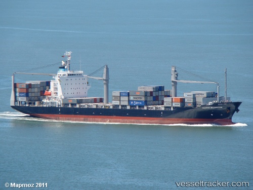
Vessel CMA CGM NACALA IMO: 9550307, MMSI: 256127000 Container Ship
UTC, 24.83008, 54.65751, course: 231, speed: 0
UTC, 24.83004, 54.65754, course: 230, speed: 0
2026-01-30 15:27:59 UTC, 24.83006, 54.65750, course: 231, speed: 0
Live AIS position:
UTC. Near Mina Khalifa/Abu Dhabi),
updated 2026-01-30 15:27:59 UTC.
Find the position of the vessel CMA CGM NACALA on the map. The latter are known coordinates and path.
marine traffic ship tracker show on live map
The current position of vessel CMA CGM NACALA is 24.83006 lat / 54.65750 lng. Updated: 2026-01-30 15:27:59 UTCCurrently sailing under the flag of Malta
CMA CGM NACALA built in 2009 year
Deadweight:
21419 tDetails:
Last coordinates of the vessel:
UTC, 24.83007, 54.65750, course: 221, speed: 0UTC, 24.83008, 54.65751, course: 231, speed: 0
UTC, 24.83004, 54.65754, course: 230, speed: 0
2026-01-30 15:27:59 UTC, 24.83006, 54.65750, course: 231, speed: 0